Search South Dakota Death Records
 South Dakota Newspapers, Full Search (1861-2002), 38 titles
- South Dakota Obituary Search - (1999-current)
- South Dakota Funeral Notices
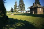 |
| Click photo to enlarge |
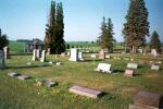 |
| Click photo to enlarge |
Beresford Cemetery
Prairie Township, Union County,
South Dakota
T95N R50W Sec 4
Lat: 43°04'12"N, Lon: 96°45'12"W
Contributed by Brian M. Hass, Apr 18, 2002, last edited Dec 17, 2004 [brian_m_hass@hotmail.com]. Total records = 898.
The Beresford Cemetery is approximately one mile south and one mile east of Beresford, SD. It is one of four cemeteries located along the north side of Union County's 298th Street. The four cemeteries are adjacent to each other and are sometimes known collectively and less formally as "the City Cemetery."
The western and eastern borders are 145 yards wide; and, the southern and northern borders are 109 yards wide. The cemetery's western border with St. John Cemetery is marked by an access road along its southern half and a row of trees along its northern half. Beresford Cemetery's eastern border with the Emmanuel Lutheran Cemetery is not as well marked; and, the two cemeteries appear to be a single, continuous cemetery. The southern border of Beresford Cemetery is marked by a fence; and, the fence stops at the cemetery's southeastern and southwestern corners. Beresford Cemetery and Memorial Park are both under the guidance of the Beresford Cemetery Association Inc.
The Beresford Cemetery is not well labelled. Of the four adjacent cemeteries, St. John is the only one to have a sign at its main entrance. This is a frequent source of confusion to people visiting from outside the local area. Many visitors who read the sign mistakenly assume that all of the four cemeteries are part of St. John Cemetery. In reality, St. John Cemetery is only the cemetery farthest west. The next three unlabelled cemeteries are (from west to east) Beresford, Emmanuel Lutheran, and Beresford Memorial Park.
The five acres of land for Beresford Cemetery were purchased in May of 1896 for two hundred and fifty dollars. The land was deeded by Mr. and Mrs. R. Z. Bennett. Surveying and fencing cost an additional one hundred fifty four dollars. In 1902, well was drilled; and, a windmill was erected. However, the windmill was destroyed in a storm later that same year. By 1909, the cemetery was finally out of debt. In 1916, a movement was made to improve the grounds; and, a tool house was built. A number of trees were added in 1939.
One and a quarter acres of land on the east side were sold to the Emmanuel Lutheran Church in 1937. According to maps of the Beresford and Emmanuel Lutheran Cemeteries; lots numbered 1-6, 19-30, 43-54, and 65-72 of blocks 1 and 4 were sold to form the Emmanuel Lutheran Cemetery. This land contained a number of graves which were once a part of Beresford Cemetery. Afterwards, a strip of land just west of the original block 1 in the Beresford Cemetery was divided up into new lots, which were designated (from south to north) as new lots 65 through 69 of block 1 of Beresford Cemetery. All of these facts probably combined into a frequent source of confusion for anyone who consulted burial records from before and after 1937. Also, lots 59 through 64 of block 4 were extended southward by two graves each; and, these new grave spaces were designated as lots 59A through 64A of block 4.
Initially, everyone cared for their own lots. The price of a lot in 1943 was ten and fifteen dollars. Later, perpetual care was adopted with an increased cost of graves. It is very well maintained. The grass is mowed regularly; and near the tool house, there is a garbage can for litter.
On the night of April 8, 1994, vandals bent twenty-eight of the fifty-nine flag poles along the cemetery's "Avenue of Flags." The poles were bent in such a way as to block the driveways; and, the damage was beyond repair. Within a short time, the three individuals responsible for the vandalism were apprehended by local police and the Union County Sheriff's Department. Fortunately, this type of incident was the exception rather than the rule.
The survey of Beresford Cemetery was conducted by Brian M. Hass. The cemetery was visited on August 19 and 26, and September 9 and 16 of 2001 for the purpose of transcribing information from the inscriptions on all of the visible grave markers. The transcriptions were compared with the earlier burial records. Any disagreements between the documents were noted and circled on a printout of the 2001 transcriptions. The cemetery was revisited on January 8 and April 17 of 2002 to determine whether the disagreements were the result of errors in the 2001 transcriptions; and, any errors that were discovered were noted and corrected. Some information was gathered from old obituaries published in the "Beresford Republic" if the information was absent from any of the burial records for unmarked graves. The dimensions of the cemetery were measured during the April 17, 2002 visit.
The 1940 WPA graves registration records were found to contain numerous name misspellings as well as few date and age errors. A few of the WPA misspellings sounded phonetically similar to the actual names when read out loud, but did not resemble those names otherwise.
This information was gathered from the following sources:
1) 2001 Beresford Cemetery Survey Notes by Brian Hass. This is a collection of hand-printed survey data and notes collected during visits to Beresford Cemetery in 2001. The data includes names; dates and places of birth, marriage, and death; and, other data obtained from grave marker inscriptions. Special care was taken to insure that all names were transcribed accurately from the markers. This document includes corrections.
2) Beresford Cemetery burial records. This document lists the names, years of death, and lot and block numbers for individuals buried at Beresford Cemetery. 3) Beresford Cemetery listing of graves, WPA Graves Registration Project, April 1940. The listing contains names, grave locations, dates of death, ages at death, genders, veteran status, and comments. This document also lists a number of graves which are actually part of the Emmanuel Lutheran Cemetery. These graves are located on land which was once a part of the Beresford Cemetery before it was sold to the Emmanuel Lutheran Church in 1937.
4) "Beresford Cemetery Assc. Inc.," pg 78 of the Beresford centennial book, Beresford:_100_Years, published in 1983 by the "Beresford Republic" and the Lennox Independent." This contained some historical information on the cemetery.
5) "Beresford Cemetery," written by members of the Twentieth Century Club, 1989. This article contained historical information on the cemetery.
6) "Beresford Republic" newspaper, Beresford, South Dakota. This contained all but one of the referenced obituaries that were used.
7) "Vandals destroy 'Avenue of Flags'," pg 1, April 14, 1994 issue of the "Beresford Republic."Because the border between the Emmanuel Lutheran and Beresford Cemeteries is not well marked, a few records had to be compared against the 2001 survey data. Burial records for both Emmanuel Lutheran and Beresford Cemeteries were checked; and, obituaries for a number of individuals buried along or near the border were also checked. If the listed place of interment within an obituary disagreed with the burial records, the burial record data was given preference. This was done to remove any ambiguities with regard to the cemetery in which these individuals were buried.
The following list includes the inscriptions from all visible grave markers. Information on unmarked graves was obtained from the second and third sources listed above.
Misc:
??, ??, no dates, probably unmarked, listed as Mrs. Roops father, data from burial records, blk. 2, lot 49
??, ??, no dates, probably unmarked, listed as Mrs. Roops mother, data from burial records, blk. 2, lot 49
??, ??, no dates, probably unmarked, records list as "child of stranger," buried in same block and lot as Dr. Trotter, data from burial records, blk. 2, lot 69